
Learn the history of our thriving little neighborhood in North Portland, Oregon.
Kenton History
Kenton History
The Kenton Neighborhood Association respectfully acknowledges that we are living on the unceded, traditional, and ancestral lands of the Kalapuya, Tlatskanai, Cowlitz, Chinook, Multnomah, and Clackamas peoples. For centuries this land was a seasonal wetland and source of Wapato and other traditional foods. In the late 19th century this watery landscape was dammed and diked and transformed into a meat packing company town that became Kenton.
The dense and varied kaleidoscope of parks, neighborhoods and industry that is the landscape of North Portland springs from its geography, cultural diversity, and history as a working community. It is a rich vernacular landscape as described by the scholar, John Brinkerhoff Jackson — one that is "layered with the traces of previous generations' struggles to earn a living, raise children, and participate in the community life."
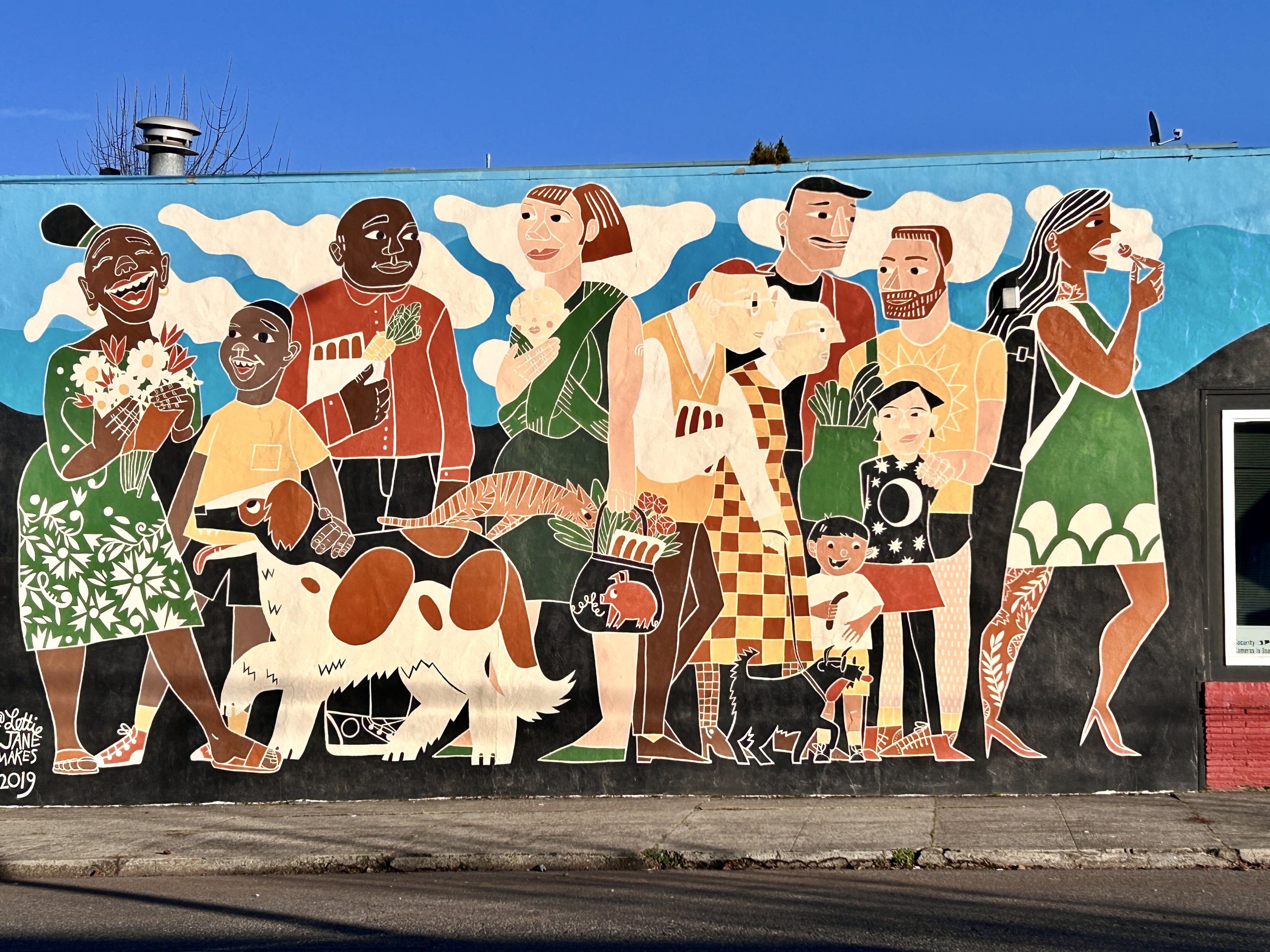
Image: Scratch Meats mural (2929 N Russet Street) by Lettie Jane Rennekamp depicts Kenton’s diversity; Photo by Alicia Gallo.
Kenton: A Swift & Company Town
The neighborhood of Kenton was originally a company town just outside of Portland, Oregon. In 1906, Swift & Company purchased the smaller Union Meat Company and began to develop the community. Swift soon employed over 1,500 workers, and by 1911 had become the central livestock market in the Northwest.
The animals were transported from Eastern Oregon and unloaded at the Albina Railroad Yard along the Willamette River. They were moved up Denver Avenue in a traditional cattle drive with cowboys on horseback. This truly western scene continued until 1928.
The distinctive rusticated stone architecture of the neighborhood is a visible reminder of Kenton's development as a planned community. The architectural cement blocks that mimic the carved stone of an Eastern Oregon cattle town were selected to welcome the ranchers and cowboys bringing the livestock to market.
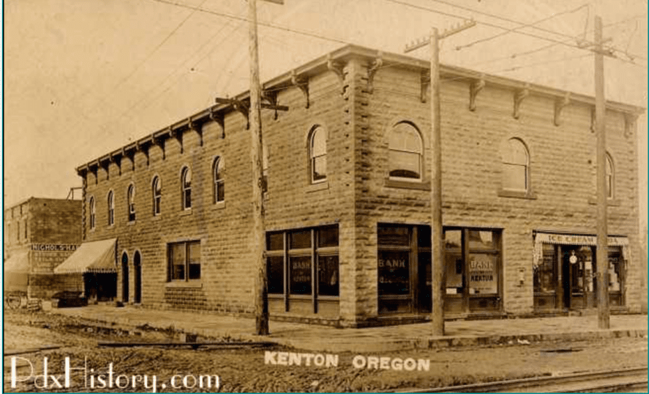
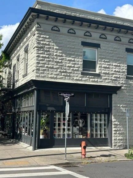
Images: Examples of the rusticated block used by Swift & Company — Bank of Kenton circa 1909 (top; Courtesy of PDXHistory.com) and current day commercial building on N Denver Avenue and N Kilpatrick Street (bottom; Photo by L. Wysong).
In 1909, the Kenton streetcar line was developed; on June 27, the 40-room Kenton Hotel opened. With this added transportation access and accommodations, the area along the Columbia Slough became increasingly inviting to industry.
By 1911, there were no less than twelve major manufacturing firms located along the slough. In 1915, the town of Kenton was annexed by the City of Portland. The area continued to grow and diversify with the opening of Berg’s Department Store and the Chaldean, an elegant movie theater.
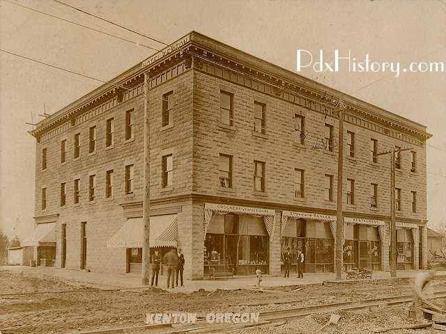
Image: The 40-room Kenton Hotel opened on Denver Avenue (then named Derby) and McClellan Street in 1911; Courtesy of PDXHistory.com.
The expansion during this time also included several sawmills which were the inspiration for the Paul Bunyan statue. The Kenton Business Association commissioned Paul in 1959 for the Oregon Centennial Celebration.
This beloved and monumental character is an iconic folk artwork that was designed by the business association and fabricated in a local machine shop.
The Paul Bunyan statue was added to the National Register of Historic Places on January 28, 2009. It is not included in the Portland Public Art Collection — so it is maintained by the neighborhood (donations are always welcome).
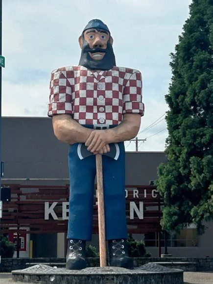
Image: Paul Bunyan statue commissioned by the Kenton Business Association 1959; Photo by L. Wysong.
On December 7, 1941, Pearl Harbor was bombed, and the US was at war. With the start of WWII, there was fear of Japanese espionage or even an invasion of the Pacific coast.
On February 19, 1942, President Franklin Delano Roosevelt signed Executive Order 9066. This authorized military commanders to create an “Exclusion Area” for all persons of Japanese ancestry along the west coast regardless of citizenship.
In the next six months, approximately 122,000 men, women, and children were forcibly moved to "assembly centers." They were then evacuated to and incarcerated in isolated, fenced, and guarded "relocation centers," also known as "internment camps.”
World War II: Stock Yards & Japanese Incarceration
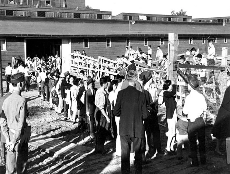
Image: American citizens of Japanese ancestry were moved to assembly centers at the Union Stockyards; Courtesy of OHS Research Library, 48789.
Japanese Americans living in the Portland and South Central Washington area were ordered to report to Noth Portland Assembly Center located at the Pacific International Livestock Exposition building by noon, Tuesday, May 5, 1942. This was a clear violation of their civil rights and was later acknowledged as unconstitutional.
The Pacific International Livestock Exposition building (originally the Portland Union Stockyards, built in 1909) was used for cattle, horses, and hogs and not fit for human habitation. Each family was assigned an animal stall. Plywood was placed on the dirt floor, but the smells and heat remained and soon became a part of daily life.
Every person was issued a rectangular paper tag and with a number. These Americans lost their homes, businesses, possessions and even their names
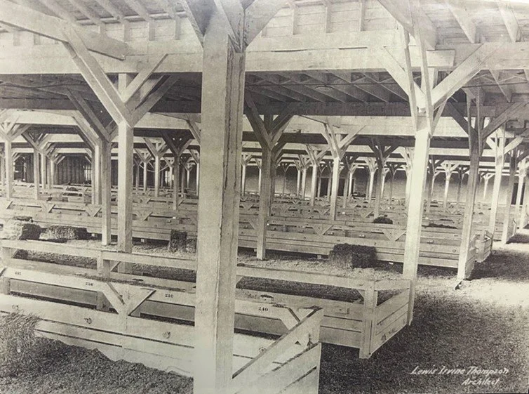
Image: Portland’s Pacific Northwest Livestock Exposition building was used as the North Portland Assembly Center in 1942.
In 2004, TriMet completed the Interstate (Yellow) MAX line and commissioned a remembrance of the Japanese Incarceration by Portland artist Valerie Otani. It included five large timber gates or torii clad with sleeves engraved with news clippings detailing the Japanese American experiences at the North Portland Assembly Center and the Incarceration Camps. The MAX Station platform includes a diagram of the center and seating in the form of traveling trunks.
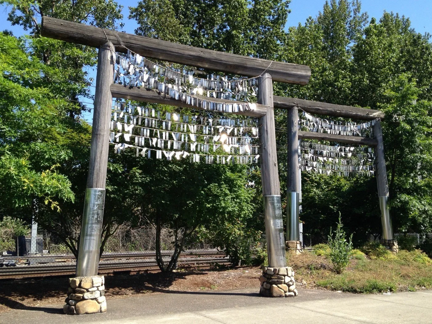
Image: Voices of Remembrance by Valerie Otani. The ropes are draped with a hanging metal identification tag for each person held in the North Portland Assembly Center; Photo by L. Wysong.
The industrialist Henry J. Kaiser established three shipyards in the Pacific Northwest, two in Portland and one in Vancouver, Washington. The Oregon Shipbuilding Corporation (Kaiser Shipyards) was founded on January 10, 1941, and soon became the nation’s largest producer of the “Liberty Ships,” ocean freight liners that were the lifeline for England and foundation of the Allies supply lines in World War II.
The company had locations on 87 acres of land on the east bank of the Willamette River, on Swan Island and in Vancouver. In two years, the population of Portland swelled by a third as 160,000 people poured into the area.
World War II: Kaiser Shipyards
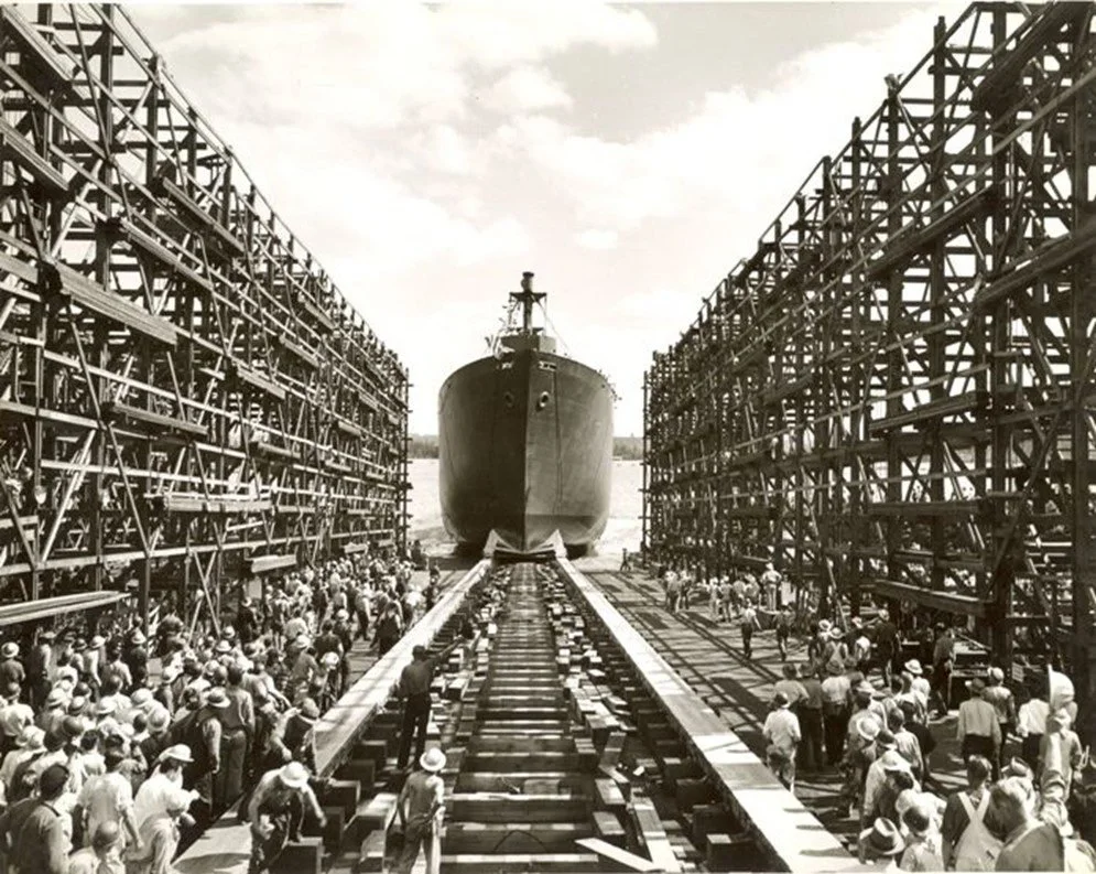
Image: Liberty ship launching from the Vancouver, Washington, Kaiser shipyards; Courtesy of NPS.
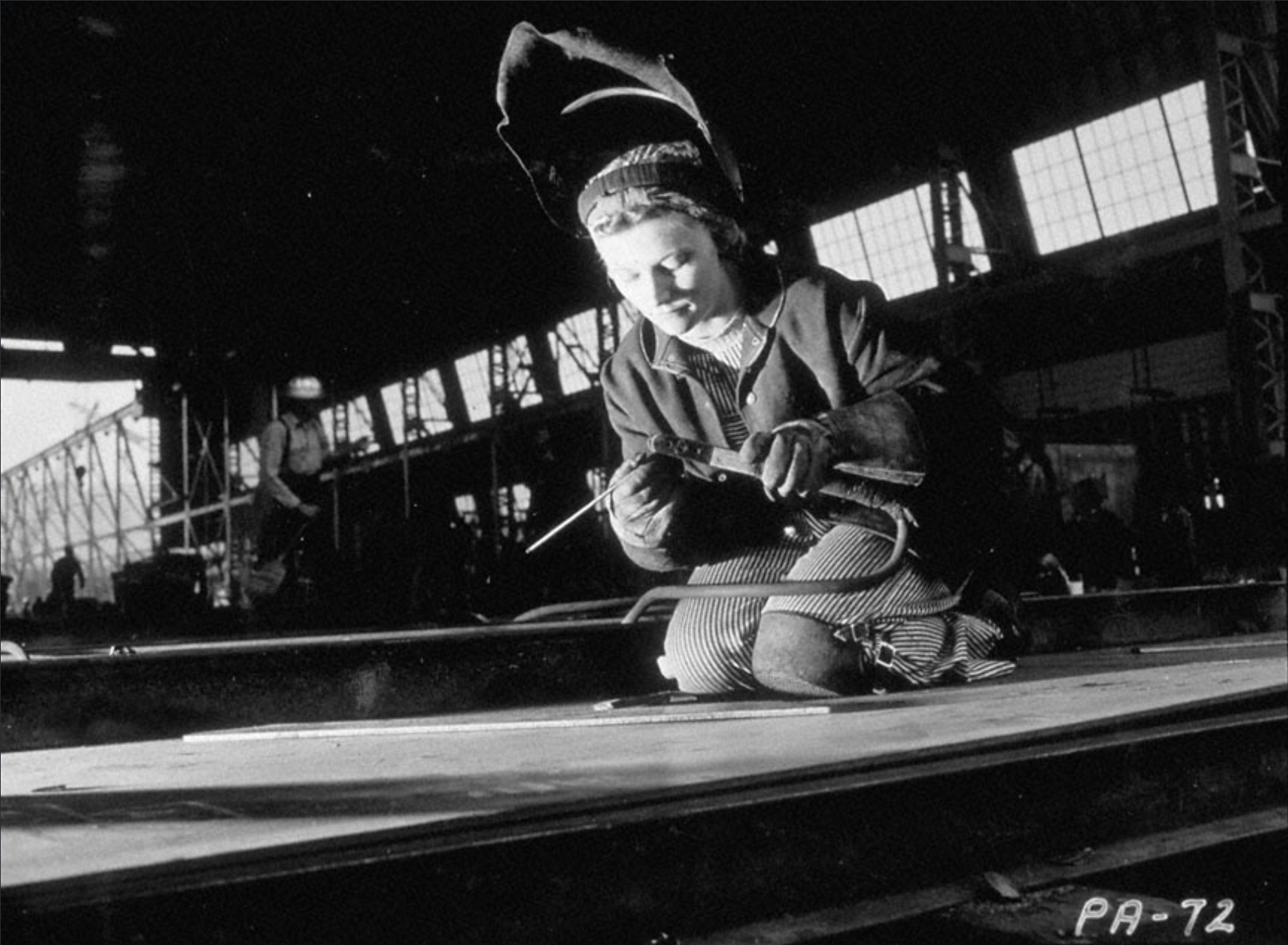
Image: Iona Murphy, a shipyard welder at the Oregon Shipyard Corporation in Portland, circa 1943; Photo by Ray Atkeson, courtesy of OHS Research Library, 96923.
The shipyards needed workers. The labor shortage was acute, and help wanted ads were distributed in eleven states. Workers, both Black and white, began to arrive. Many rode the 17-car trains known as the “Kaiser Karavans” and settled in the new City of Vanport. The war and the shipbuilding industry changed the course of Portland history and transformed the neighborhood of Kenton.
The wetlands along the Columbia River were a maze of lakes that was filled and reconfigured by the Army Corps of Engineers. For many years this reclaimed land was used by the meat packing industry.
In 1942, this area was selected as a temporary housing project for the families of the men and women who came to work in the Kaiser Shipyards during World War II. In August 1942, Henry J. Kaiser purchased 650 acres north of the Columbia Slough, just outside of the Portland city limits.
Vanport: 1942-1948
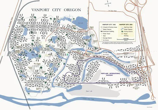
Image: Map of Vanport City with a contemporary overlay; By Sarah Bagley, PSU Geography.
Construction was fast tracked and the first families moved into their new homes in December 1942. The name Vanport combines Vancouver and Portland.
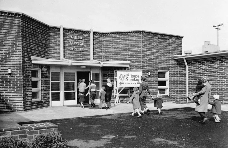
By 1945, there were over 42,000 people living in Vanport making it the second largest city in Oregon and the largest wartime housing project in the United States. It boosted a hospital, library, theater, schools, 24-hour day care, a college (later Portland State University), and police and fire stations.
Image: "Open House Sunday" at one of the Kaiser Company's federally-funded child service centers in Vanport; courtesy of OHS Research Library, 78701.
Families came from over 40 different states and included people of color. During the height of production 20% of the population was African American. With the end of the war many workers returned home or moved to other parts of Portland but the entrenched real estate red lining made finding housing extremely difficult for Black families. The proportion of African Americans in Vanport rose to 35%.
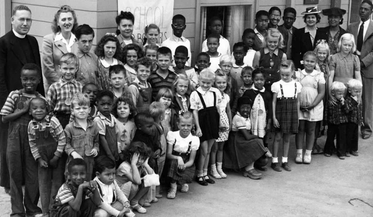
Image: Vanport City Vacation Bible School, August 1943; courtesy of OHS Research Library, 78867.
At the end of WW II in 1945, the population of Vanport decreased but many people continued to live in the affordable housing. It was a vibrant integrated community that included many returning veterans attending the newly established Vanport College.
This all changed in May 1948 when a combination of warm temperatures and heavy rain brought the Columbia River to dangerously high levels. In spite of concerns, City authorities and the Red Cross decided not to alert the inhabitants because they did not want to shelter Black families in Portland.
The residents were not evacuated or warned. Rather, on Memorial Day, May 30, 1948, residents found flyers with this reassuring message on their doorsteps: “Dikes are safe at present. You will be warned if necessary. You will have time to leave. Do not get excited.”
Vanport Flood
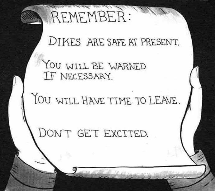
Image: Excerpt from THE VANPORT FLOOD, an Oregon history comic by Nicole J. Georges, Ed Washington & Sarah Mirk.
The dike broke at 4:17 pm — sending a 10-foot wall of water into Vanport. Residents had 30 minutes or less to escape to N Denver Avenue and higher ground. As the wave of water moved through the community, the quickly assembled buildings were swept off their non-existent foundations.
As one resident recalled: “We could see the housing units colliding and collapsing ... Everybody who made it to the highway was just screaming. I never seen anything like it. I thought it was the end of the world. ” (Rosa Lee Washington interviewed in 1992)
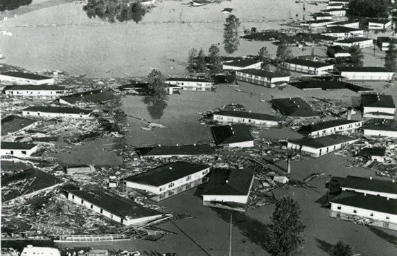
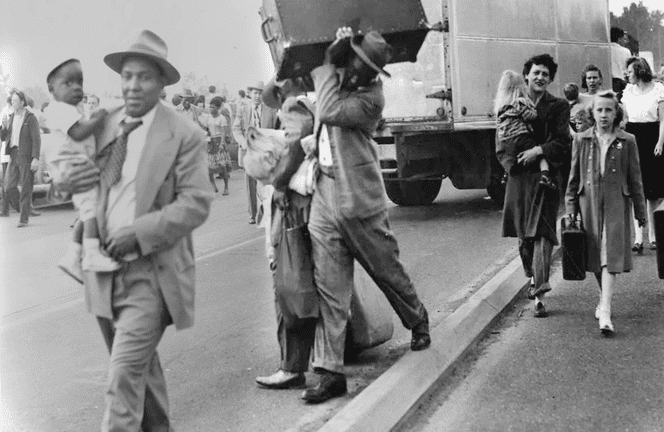
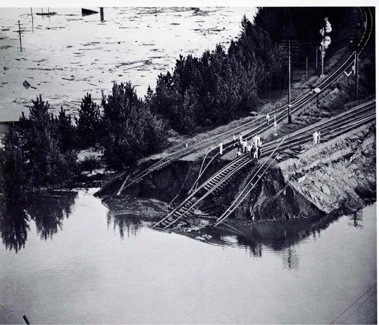
Images clockwise: 1) Vanport homes were swept off their temporary foundations in 30 minutes; courtesy of OHS Research Library. 2) Vanport’s 18,500 residents evacuated and lost everything; copyright HistoricPhotoArchive.net. 3) Railroad dike break on Memorial Day 1948. This is now the Blue Heron Lakes Golf course; courtesy of OHS Research Library, 68784.
Portland in the 1950s and 1960s was a place of tumult, “urban renewal” policies, and neighborhoods decimated by civic projects. See the Oregon History Project for details.
Kenton experienced the legalization of drag racing and the establishment of the Portland International Raceway.
Luckily, Kenton was not as impacted by urban renewal changes and conflicts as the central city; it has maintained its vibrant walkable downtown and now has a historic conservation overlay.
Former Vanport Streets Become Racing Site
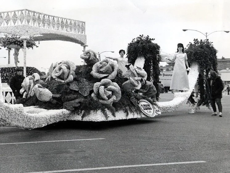
Image: The racetrack had its official inauguration in 1961 as part of the Portland Rose Festival.